

The campaign will produce detailed 3D maps of the seafloor and coastline between Riverton and Waituna Lagoon.
Search results for "LINZ"
LINZ geospatial and property milestones in 2022–23
More than 3 million property searches and more than 100,000 registered users are some of the impressive stats.

LINZ tertiary GIS scholarship applications open
The scholarships, up to a maximum of NZ$5,000, aim to encourage students to take up geospatial studies.

LINZ Data Service rolls out new-look website
The new web interface is more customisable and provides access to a wealth of geospatial data.

Meikle takes reins as LINZ acting Chief Executive
Adrienne Meikle will serve until February 2024, bringing extensive public sector career experience.

LINZ assists clients in wake of Cyclone Gabrielle
Essential services are being maintained in the wake of the Southern Hemisphere’s costliest cyclone.

LINZ Lands & Survey Surveying Projects In Antarctica: 1970s – Present Day
When:
25 January, 2023 @ 4:00 am – 5:00 pm
Where:
Webinar
Since the establishment of Scott Base on Ross Island by the late Sir Edmund Hillary in 1957, surveyors have been appointed to assist scientists with survey related tasks on the ice. This presentation by a[…]
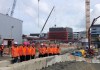
City Rail, LINZ collaborate on tunnel project
The 3.45km twin-tunnel underground rail link will run up to 42 metres below Auckland City.
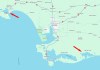
LINZ begins Banks Peninsula seabed survey
3D seafloor data will be captured within 5 km of the shore and up to 70m deep in some places.
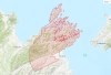
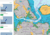
LINZ releases Marlborough hi-res 3D mapping data
3D mapping data for New Zealand’s Marlborough region has been released as part of a LiDAR elevation data project.


