


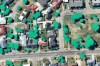
Users will have access to tools and aerial imagery covering metro areas across Australia and New Zealand.
Search results for "aerial imagery"
Critchlow launches new EO imagery marketplace
New Zealand’s Critchlow Geospatial has launched what it says it the country’s first satellite imagery marketplace.

Cook Islands issues LiDAR, imagery contract
The contract will see Woolpert collect topographic and bathymetric LiDAR data and aerial imagery across the islands.
Nearmap starts production of new aerial solution
The company has completed the research and testing phase for its new HyperCamera3.

Seequent acquires geo-imagery specialist Imago
Bentley’s Seequent business has acquired Imago, a developer of cloud-based geoscientific imagery software.
iXblue launches Brisbane-based aerial division
iXblue launches a suite of aerial services alongside its surface and subsea bathymetric capability.

Nearmap’s new product accelerates access to 3D imagery
Nearmap launches its streaming 3D offering at Navig8 events across the country.

SimActive software for rapid processing of imagery
SimActive software for rapid processing of imagery Developed by SimActive, Correlator3D™ software is a patented end-to-end photogrammetry solution for the generation of high-quality geospatial data from satellite and aerial imagery, including drones. Supported data include: All cameras and sensors mounted on UAVs (e.g. infrared and multispectral) All medium / large format cameras installed on aircrafts, […]

SimActive software for rapid processing of drone imagery
Correlator3D™ software is a patented end-to-end photogrammetry solution for high-quality geospatial data from satellite and aerial imagery

Aerial imaging market valued at $5.3bn by 2024
Huge uptake in UAVs for aerial capture, and diversifying applications are driving a boom in demand.


